
WALKS · OLLE ROUTE 2
Jeju Olle Route 2 Ends at Our Door: Gwangchigi to Onpyeong
Distances and waypoints · Siksanbong detour · Stamps and lunch · Bus to the start
Published 4 min read
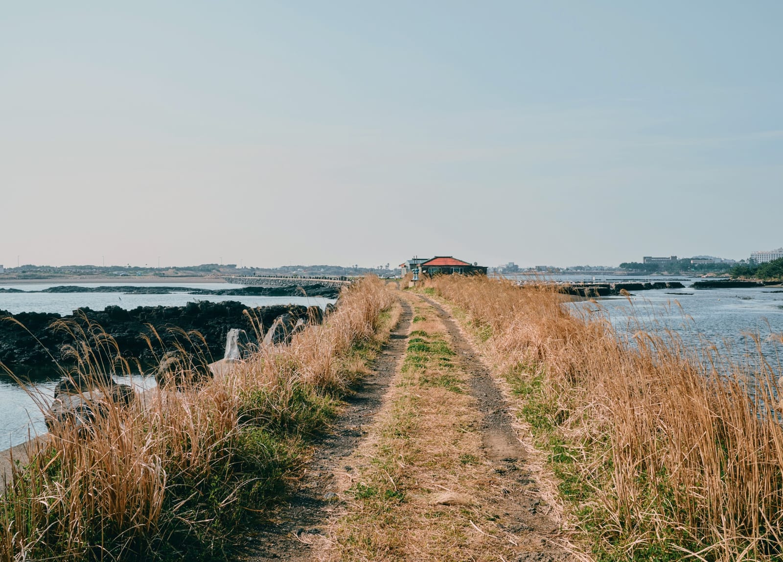
Jeju Olle is a network of long-distance walking routes that circles the island, and Route 2 runs from Gwangchigi Beach through the Ojo-ri lagoon, over Daesusanbong and past Honinji pond to Onpyeong Port. Officially it is 14.8 km, 4 to 5 hours, medium difficulty (as of October 2026). The finish is the port a few minutes from our house, so you can bus to Gwangchigi in the morning and walk home by evening. Sea, wetland, volcanic hill and village follow one another, which makes it more varied than Route 1.
Waypoints and distances
- Gwangchigi Beach (0 km) — The start stamp. At low tide the beach becomes a shelf of mossy rock with Seongsan Ilchulbong straight ahead.
- Ojo-ri lagoon embankment — An earthen path along the still water inside Seongsan harbour, pictured above. The mudflat became Jeju's first protected wetland in December 2023 and draws migratory birds in winter.
- Siksanbong (2.9 km) — A 66 m volcanic cone and Korea's largest wild stand of yellow hibiscus, which flowers in July and August. Since 30 September 2026 the path below it is bypassed because it floods.
- Ojo-ri office (3.8 km) and Goseong-ri — The route was changed in September 2025 and now follows the road past Seongsanpo Catholic Church and the Goseong five-day market. This is where most of the route's shops are.
- Daesusanbong summit (7.6 km) — The middle stamp. A beacon-tower hill of about 130 m reached through cedar and black pine forest. From the top you see Seongsan Ilchulbong, Seopjikoji, Udo and the fields of Siheung-ri where Route 1 begins.
- Honinji (12.7 km) — The pond where, in Jeju's founding legend, three demigods married three princesses. Famous for hydrangeas in June, with toilets and parking.
- Onpyeong Port (14.8 km) — The finish stamp. A small harbour with a restored old stone lighthouse and a stretch of coastal fortress wall, and the start of Olle Route 3.
The 2026 Siksanbong detour
A Jeju Olle notice of 30 September 2026 introduced a detour that goes directly from Ojo Port to Ojo-ri village instead of around Siksanbong. The 1.6 km section shrinks to 0.4 km, so the walk is about 13.6 km in practice. Detours are marked with two orange ribbons. No end date was announced (as of October 2026), so check the route news on the Jeju Olle website before setting out. If you want to see the yellow hibiscus, Siksanbong can be visited separately from Ojo-ri village.
Stamps, markers and lunch
- Stamps — Start at Gwangchigi Beach, middle at the Daesusanbong summit, finish at Onpyeong Port. The paper passport and the mobile passport each cost 20,000 won and are not linked. Route 2 has no official information centre, so buy a passport at the Route 1 centre at the Malmi Oreum entrance or at the Traveller Centre in Seogwipo (as of October 2026).
- Markers — Blue arrows point forward, orange arrows backward. The "ganse", a marker shaped like a Jeju pony, points its head the way you should go. If you lose the markers, go back to the last one you saw.
- Lunch — Jeju Olle's official advice is to eat before Daesusanbong, because there are no restaurants or shops after it. Restaurants cluster near the Goseong five-day market and along the main road, and the last 7 km has almost nowhere to rest apart from the toilets at Honinji. Fill water bottles in Goseong.
Seasons and safety
Rapeseed flowers bloom around Gwangchigi and the foot of Daesusanbong from late February to early March, hydrangeas at Honinji in June, yellow hibiscus on Siksanbong in July and August, and migratory birds arrive on the lagoon in winter. Jeju Olle recommends long sleeves and trousers even in summer because of ticks in the grass, and asks walkers to stop by 6 pm in summer and 5 pm in winter. Solo walkers are asked to phone the Olle call centre (064-762-2190) when they set out. Take care crossing Road 1132 after Daesusanbong.
Getting to the start, and linking Routes 1 and 3
Gwangchigi Beach is about 7 km, 10 minutes, from the house by car. By bus, take the 201 towards Jeju City from the Onpyeong-ri stop and get off at Gwangchigi Beach, but note that some Jeju-bound buses run via Ojo-ri and skip that stop, so check before boarding. Buses run every 15 to 22 minutes (as of October 2026). A Seongsan taxi (064-784-3030) is a 10-minute ride. Route 1 ends where Route 2 begins and Route 2 ends where Route 3 begins, so with the house as a base you can walk Route 1 and Route 3 on consecutive days. For the pond's story, see our Honinji legend walk.
Places in this guide
Map of places
Numbers match the map pins. Open any place in Kakao Map, Naver Map or Google Maps.
Map data © OpenStreetMap contributors
Sight
Gwangchigi Beach
Best reflection view of Ilchulbong · changes with the tide
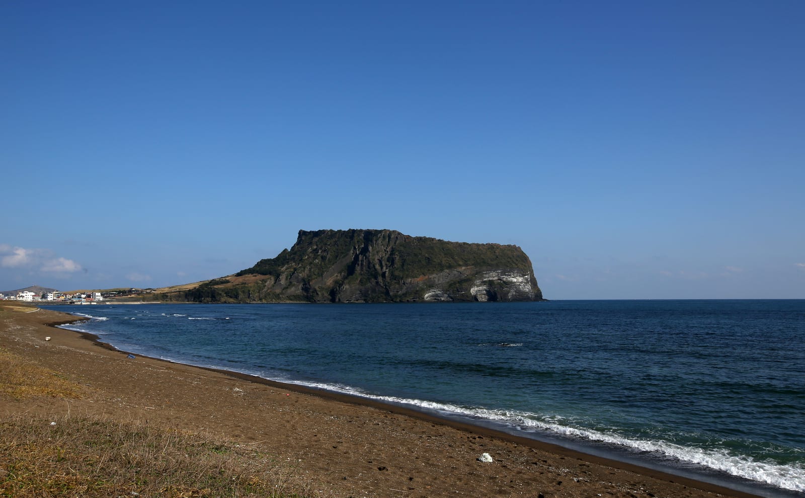
Photo: Korea.net (Republic of Korea) · CC BY-SA 2.0 · Wikimedia Commons Walk
Siksanbong
66 m cone · yellow hibiscus Jul–Aug · bypassed Oct 2026
Walk
Daesusanbong (Keunmulmoe)
Route 2 middle stamp · view of Ilchulbong and Seopjikoji
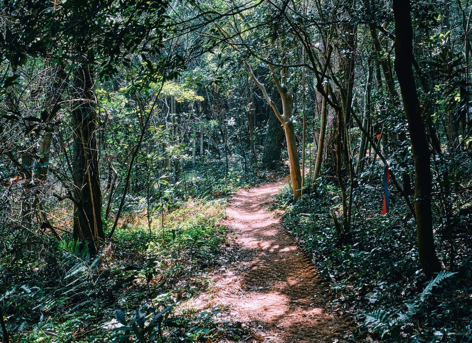
Photo: Jeju Olle Foundation · CC BY-SA 4.0 · Wikimedia Commons Sight
Honinji Pond
Founding-legend wedding pond · Provincial Monument No. 17 · free entry
Walk
Onpyeong Port
End of Olle Route 2 · start of Route 3
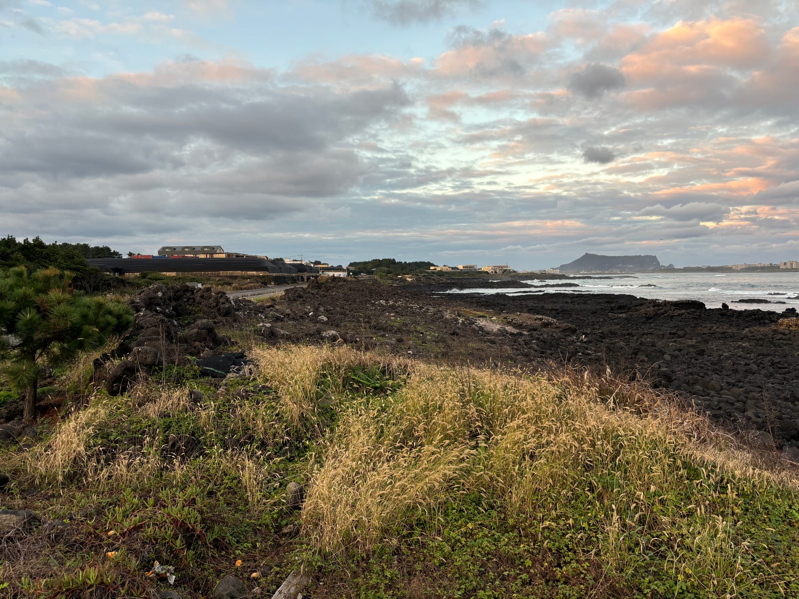
Photo: Chipmunkdavis · CC BY-SA 4.0 · Wikimedia Commons Stay
Jeju Daily
Private house, one group a day · about 5 min by car from Ilchulbong

Questions
Questions
Q. Can I walk Route 2 in reverse, from Onpyeong to Gwangchigi? +
Q. How long will the Siksanbong detour last? +
Q. Can Route 1 and Route 2 be walked on consecutive days? +
Read next
Read next
THE VILLAGE WHERE ROUTE 2 ENDS · ONPYEONG
Jeju Daily
A single-story private house in Onpyeong, the village where Olle Route 2 finishes. Collect your final stamp at the port and a few minutes later you can take your boots off on the lawn. Three bedrooms, two baths, a wide lawn and BBQ deck. Up to 12 guests, with the same rate from 1 to 6.