
WALKS · OLLE ROUTE 1
Where Jeju Olle Began: Route 1 from Siheung to Gwangchigi
Malmi Oreum and Aloreum views · Jongdal-ri salt fields and coast road · Centre and stamps · Buses there and back
Published 5 min read
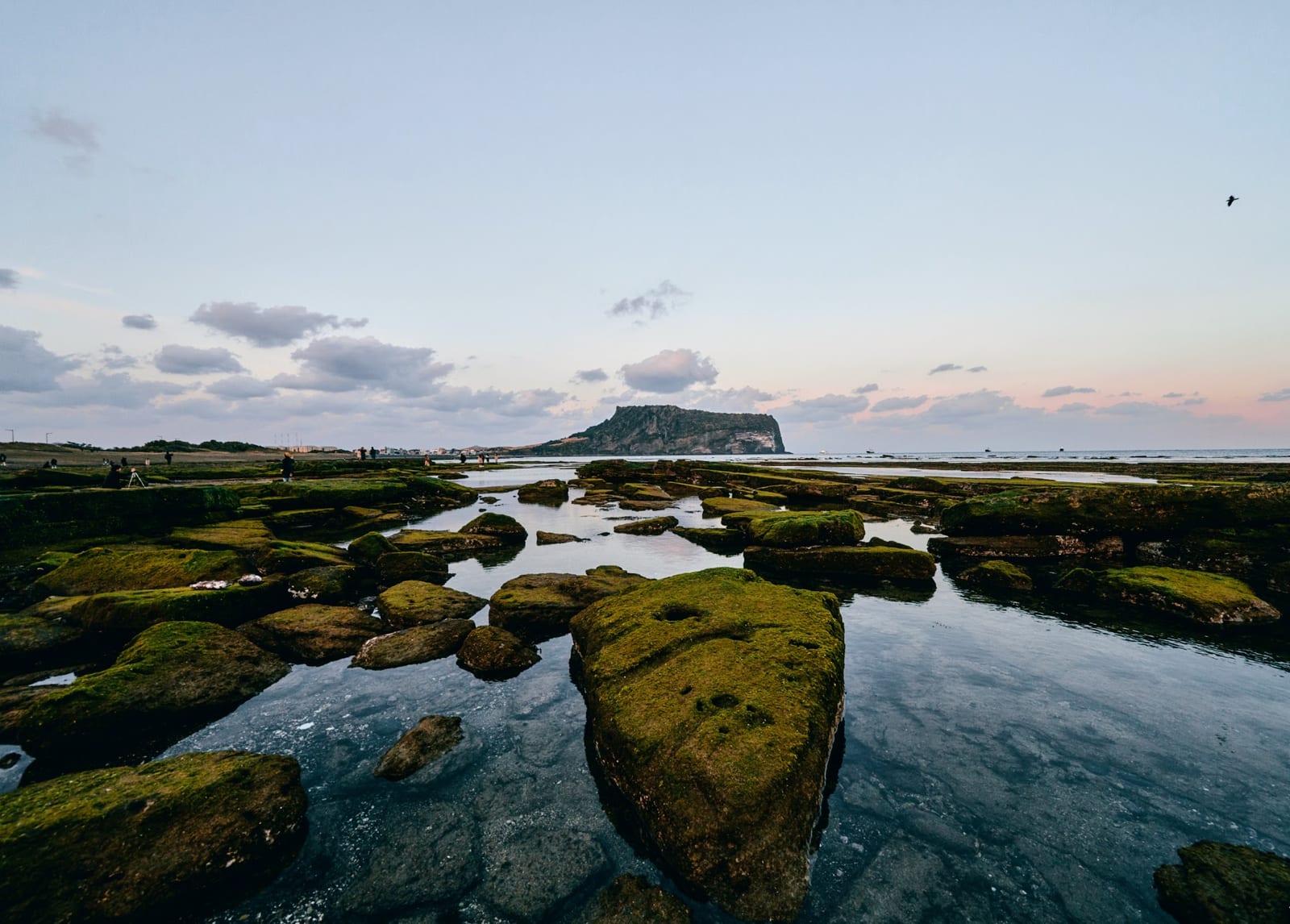
Jeju Olle is the network of walking routes that circles Jeju, and Route 1 is where it all started. It leaves Siheung-ri in Seongsan-eup, crosses the volcanic hills Malmi Oreum and Aloreum, follows the old Jongdal-ri salt fields and the coast road beneath Seongsan Ilchulbong, and ends at Gwangchigi Beach. Opened in September 2007, it is officially 15.1 km, 4 to 5 hours, medium difficulty (as of October 2026). Both hills come in the first 3 km and everything after 6 km is flat beside the sea, so you earn the view early and then walk it down to the water. The start is 15 minutes from the house by car.
Waypoints and distances
- Siheung-ri bus stop (0 km) — About 150 m from the stop stands the start stamp, a pony-shaped marker. The route crosses a patchwork of fields hemmed by black stone walls before climbing.
- Malmi Oreum (1.8 km) — Also called Dusanbong, 126.5 m high. From the top you see the Seongsan plain, Seongsan Ilchulbong straight ahead and Udo to its left, as in the place photo below. It is one of the few hills in east Jeju that faces the sunrise, so some people climb before dawn.
- Aloreum summit (2.8 km) — A small cone that sits inside Malmi Oreum's crater like an egg, which is what its name means. On a clear day the view adds Hallasan and Darangswi Oreum to Ilchulbong and Udo. The path then drops to Jongdal-ri.
- Old Jongdal-ri salt fields (6.5 km) — Jeju has few mudflats, so salt was scarce. Here villagers boiled seawater in iron cauldrons from the mid-Joseon period into the 1900s, until land reclamation in the 1960s ended it. Today it is reed beds and rice paddies.
- The coast road and the haenyeo restaurant — Jeju Olle describes the road from Jongdal past Siheung to Seongsan as one of the longest and most beautiful coast roads on the island. Siheung Haenyeo House, run by women divers, is known for abalone and clam porridge, and the middle stamp is at the Mokhwa rest stop at 8.1 km.
- Seongsan floodgate (11.1 km) and Sumapo (13.7 km) — Past the harbour the route enters the shore beneath Ilchulbong. Sumapo is the cove from which Jeju horses were shipped to the mainland in the Joseon era, and 23 tunnels dug by the Japanese army at the end of the Pacific War remain in the cliff.
- Teojinmok and Gwangchigi Beach (15.1 km) — After Teojinmok, a memorial site of the 1948 Jeju Uprising, you reach the finish stamp at Gwangchigi Beach, where low tide exposes a shelf of mossy rock.
Information centre, stamps and markers
- Centre — The official Route 1 centre is at the Malmi Oreum entrance (Siheungsangdong-ro 53beon-gil 88-46), open 08:30 to 17:00 with a lunch break from 12 to 1, closed on Lunar New Year's Day and Chuseok (as of October 2026). Staff explain how Jeju Olle began and sell maps and passports. Routes 2 and 3 have no such centre.
- Stamps — Start at Siheung-ri, middle at the Mokhwa rest stop, finish at Gwangchigi Beach. The paper and mobile passports each cost 20,000 won and are not linked.
- Markers — Blue arrows point forward and orange backward, and the pony-shaped "ganse" points its head the way to go. Ribbons come in pairs, blue for the sea and orange for tangerines.
- Udo Olle, Route 1-1 — The 13.2 km loop of Udo island, reached by ferry from Seongsan Port, is a branch of Route 1. Pair it with our Udo day trip.
Where to eat and rest
Jeju Olle's official note says there are restaurants on the coast road between Jongdal-ri and Seongsan and several more after the floodgate. Siheung Haenyeo House (064-782-9230) and the Mokhwa rest stop (064-782-2077) anchor the middle of the route; hours vary, so check before you go. The 3 km over the hills has little shade and the coast road after 6 km is paved, so a hat and water are essential at midday in summer. Jeju Olle recommends long sleeves and trousers even in summer because of ticks, and asks walkers to stop by 6 pm in summer and 5 pm in winter. An official notice warns of flooded sections in the rainy season, so avoid the route right after heavy rain.
The wheelchair section and shorter walks
The 4.6 km from the old salt fields (Jongdal-ri 814-5) to the Seongsan floodgate is fully paved and designated by Jeju Olle as wheelchair-accessible. With a stroller or older relatives, walk only this part and catch a bus in Seongsan. If you only want the view, walk the 3 to 4 km from Siheung-ri over Malmi Oreum and Aloreum to Jongdal-ri and ride the 201 back.
Getting there and back
The start at Siheung-ri is about 12 km, 15 minutes, from the house by car. By bus, take the 201 towards Jeju City from the Onpyeong-ri stop, through Seongsan, to the Siheung-ri stop. Buses run every 18 to 25 minutes from 05:35 (as of October 2026). Guidance says there is no parking at the start, so leave the car. From Gwangchigi Beach back to the house is about 7 km, 10 minutes by car, or take the 201 towards Seogwipo from the Gwangchigi Beach stop to Onpyeong-ri. A Seongsan taxi (064-784-3030) is a 10-minute ride. The next day, Olle Route 2 takes you from Gwangchigi back to the port in front of the house.
Places in this guide
Map of places
Numbers match the map pins. Open any place in Kakao Map, Naver Map or Google Maps.
Map data © OpenStreetMap contributors
Transit
Olle Route 1 start and info centre (Siheung-ri)
150 m from Siheung-ri stop · centre 08:30–17:00
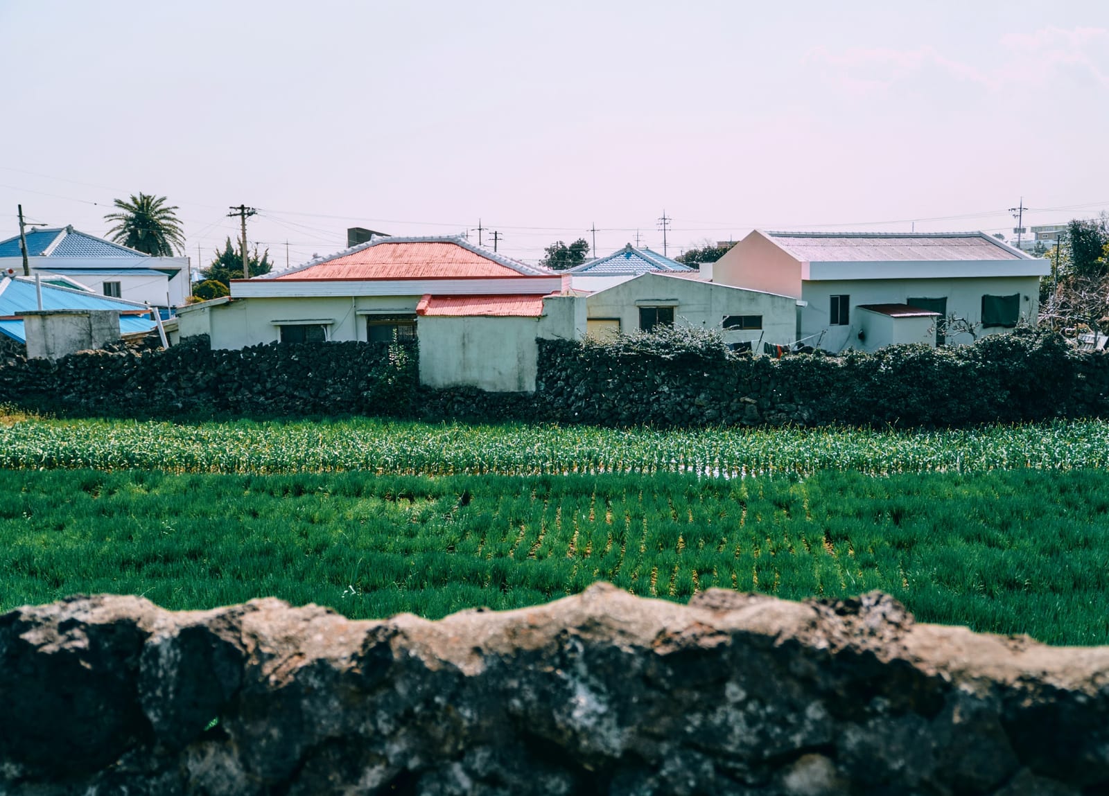
Photo: Jeju Olle Foundation · CC BY-SA 4.0 · Wikimedia Commons Walk
Malmi Oreum (Dusanbong)
126.5 m · Ilchulbong and Udo view · Route 1 km 1.8
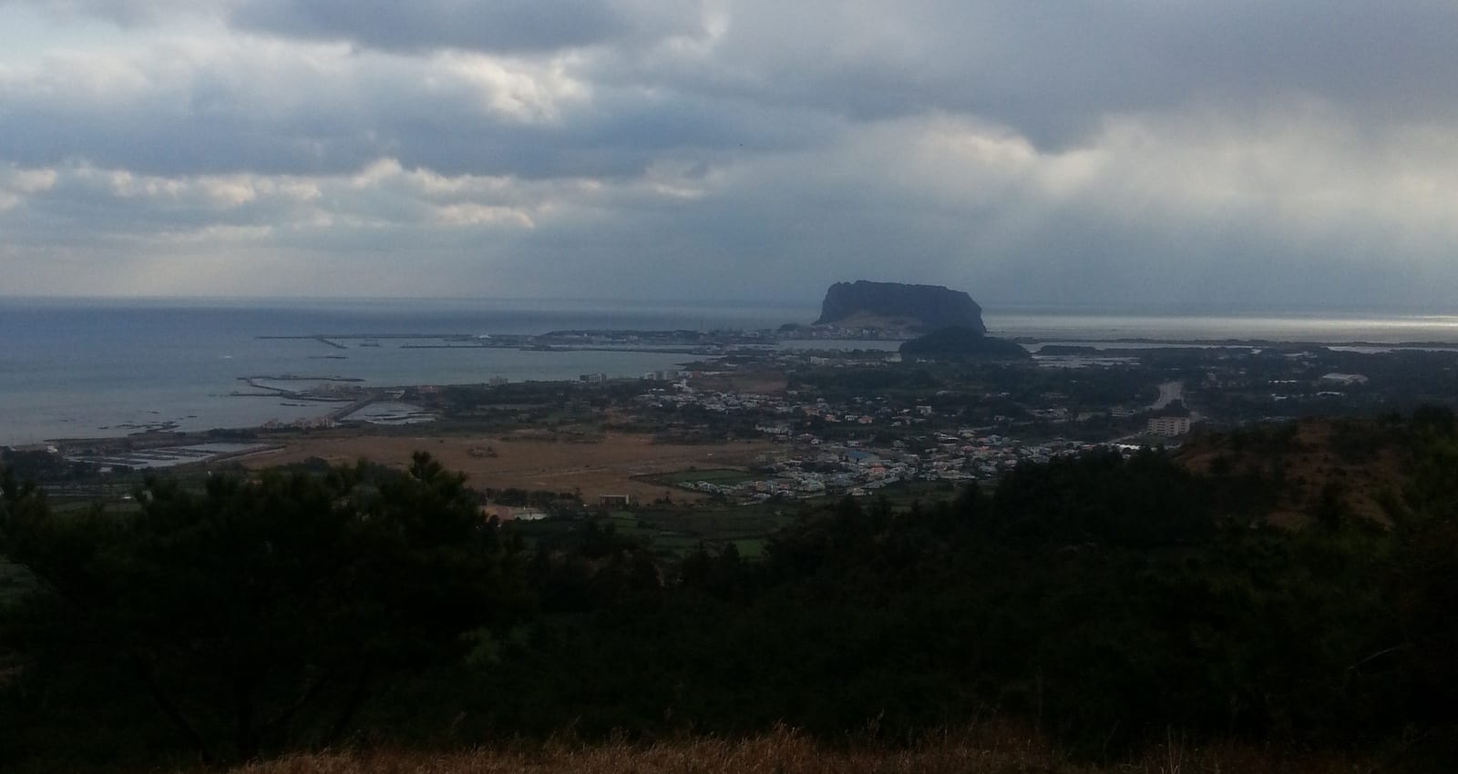
Photo: · CC BY-SA 3.0 · Wikimedia Commons Sight
Jongdal-ri old salt fields
Jeju's first salt works · reed beds · wheelchair section starts
Food
Mokhwa rest stop
Route 1 km 8.1, middle stamp · coast-road diner
Food
Siheung Haenyeo House
Abalone and clam porridge by haenyeo · check hours
Sight
Gwangchigi Beach
Best reflection view of Ilchulbong · changes with the tide
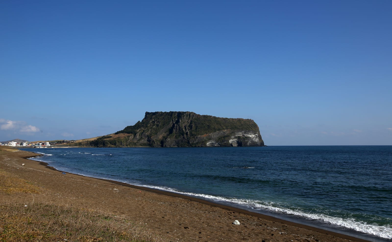
Photo: Korea.net (Republic of Korea) · CC BY-SA 2.0 · Wikimedia Commons Stay
Jeju Daily
Private house, one group a day · about 5 min by car from Ilchulbong

Questions
Questions
Q. Why is Route 1 called the first route? +
Q. Can I skip the two hills and walk only on the flat? +
Q. Can I walk Route 2 the day after Route 1? +
Read next
Read next
BETWEEN OLLE ROUTES 1, 2 AND 3 · ONPYEONG
Jeju Daily
A single-story private house 10 minutes by car from Gwangchigi Beach, where Route 1 ends, and steps from Onpyeong Port, where Route 2 ends and Route 3 begins. A good base for walking all three on consecutive days. Three bedrooms, two baths, a wide lawn and BBQ deck. Up to 12 guests, with the same rate from 1 to 6.